Waterway Surveys - Lincolnshire
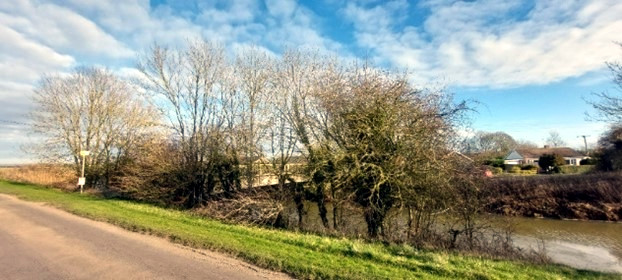
We were commissioned to survey 8m miles of Fenland drains to ensure that trees were not currently obstructing the drains or there was a risk of causing future blockages from falling trees or branches. The trees were also surveyed to make recommendations to ensure the trees could be maintained in a safe condition in relation to the adjacent public road and residential properties. Surveys were carried out in winter to enable any urgent tree works that were identified as necessary could be carried out prior to the breeding bird season.
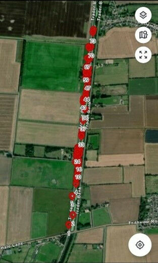
We tailored our app to ensure all the key reporting requirements of our client were achieved as they had quite specific requirements in terms of how the areas surveyed were recorded so that it would fit in with their systems and would provide ease of data uploads (Image 1).
Some of these trees were recommended for tree works as hazardous branches were identified close to a public foot bridge. Site hazards were also recorded to help with safe and efficient work planning such as detailing the overhead power line that was in close proximity to these trees.